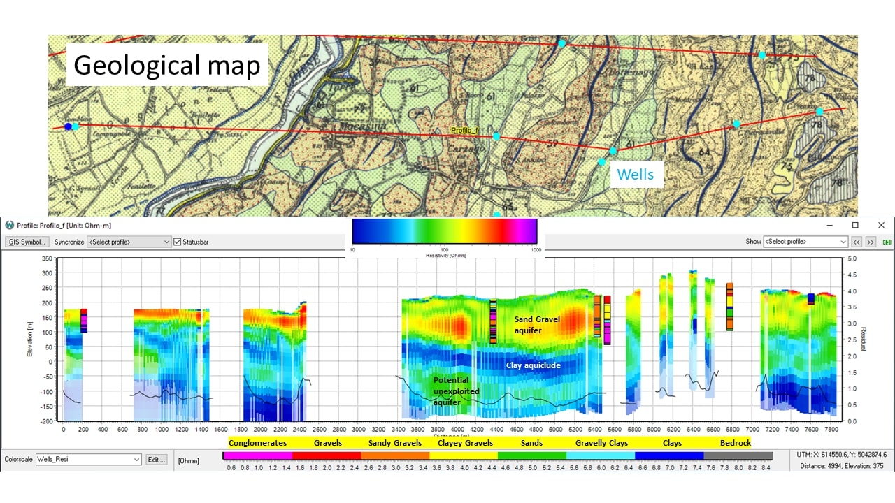
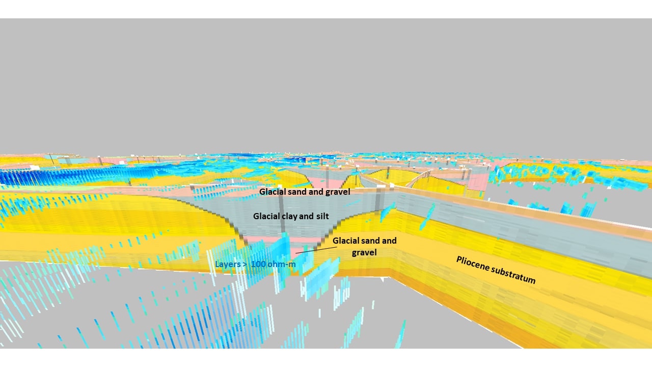
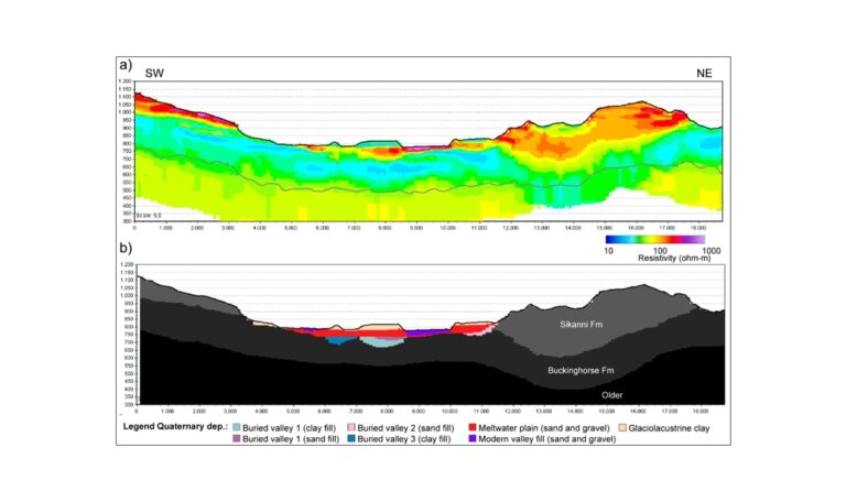
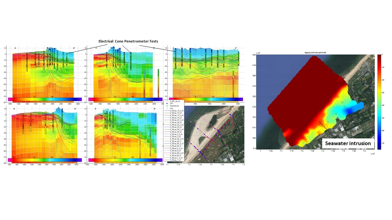
An advanced processing/modelling of AEM data is crucial for Hydrogeological applications, as we need to catch detailed and complex resistivity structures. Furthermore, just resistivity is one of the most diagnostic physical parameter for hydrogeological modeling, since it is strictly linked with hydraulic conductivity and water quality.
Our huge experience all over the World, in very different geological settings, allows us to offer a wide span of solutions: either in granular or fractured aquifers, either for freshwater detection or seawater wedge mapping.
Thanks to our exclusive parternship with NRG Europa, we can support each steps of any hydrogeological projects: from the feasibility study to the prospect planning, from the Quality Control of the AEM acquisition to the data processing, from the customized inversion mode (smooth, blocky or sharp) to the utilization of ancillary data (borehole logs, other Geophysics,…), from the resistivity model interpretation until the support in preparing a detailed hydrogeological model.
We aim at achieving:
- The highest resolution capability of AEM
- A detailed assessment of resistivity modeling with available stratigraphic data
- An effective support for the following geological/hydrogeological interpretation
The maximum possible extraction of info from the AEM survey
An efficient use of any available info, in the form of logs, cross-sections, surfaces and so on, allows us to reach the best results. Data are presented as:
- Quality Control Maps (data misfits, depth of investigation)
- Resistivity/Conductivity slice maps (both in elevation and depth)
- Vertical profiles
- 3D visualization
The resistivity model can be easily translated into a geological/hydrogeological one.
Cognitive or automatic picking of the geological contacts, as interpreted by using ancillary info (geological maps and stratigraphic logs) can provide a detailed starting point for any flow models.
The most relevant applications of AEM for Hydrogeology are:
- Groundwater mapping
- Seawater intrusion
- Pollution detection
- Vulnerability assessment of aquifers
- Groundwater quality estimation


